Map of Pontypandy in Fireman Sam
I want to introduce my children (small single digit ages) to tabletop-style role playing games, but they’re a little too young for the full deal. Instead, we have experimented with creating interactive stories where I give the children an objective, I narrate but pause frequently to let them make choices, and then I come up with consequences of those choices.
To keep it interesting, I’m trying to use settings they know from books and tv shows. One of the settings we have been returning to frequently is the town of Pontypandy from Fireman Sam.
Unfortunately, either I’m a terrible narrator, or my children still don’t have enough verbal skills and short-term memory to engage with the adventure. They grow bored and don’t really remember their earlier choices, so any long-term consequences are meaningless.
I have been considering adding a map as a visual aid, but there are no maps online of Pontypandy in its modern shape! So on a rainy day recently, we pulled up a bunch of episodes of Fireman Sam on a laptop, took screenshots of the in-show map segments, and stitched them together into a larger map. It had to be a very sloppy job in order to not lose the interest of the children, but they enjoyed most of the process.
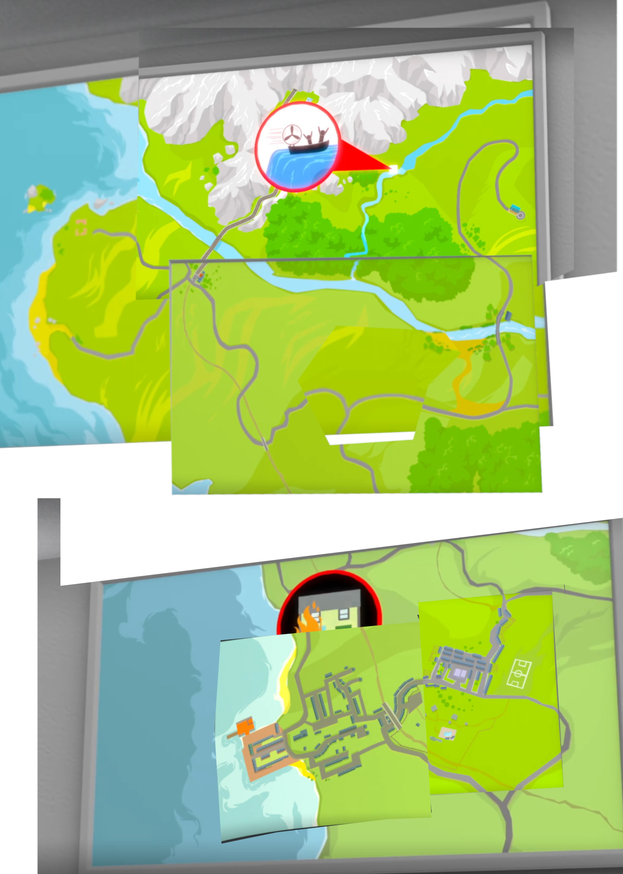
As you can tell, we have not figured out how the northern parts of the country connect to the town. We also discovered a few inconsistencies where magnified helicopter views disagree with the satellite-style imagery we’ve used for the above image.1 For exampe, the road branching northwest from the northern road away from the main fire station seems to take a different path – and be surrounded with buildings – in one of the detail maps we found.
But we took some liberties and converted this into a paper map.2 The grid is not meaningful; it was just to make it easier to copy the map faithfully from Gimp. In the stitched image, we configured the Gimp grid lines to be 100 pixels apart. This, in combination with the A4 paper size, happened to perfectly match one of the scales on my architect’s scale, which made the job easier.
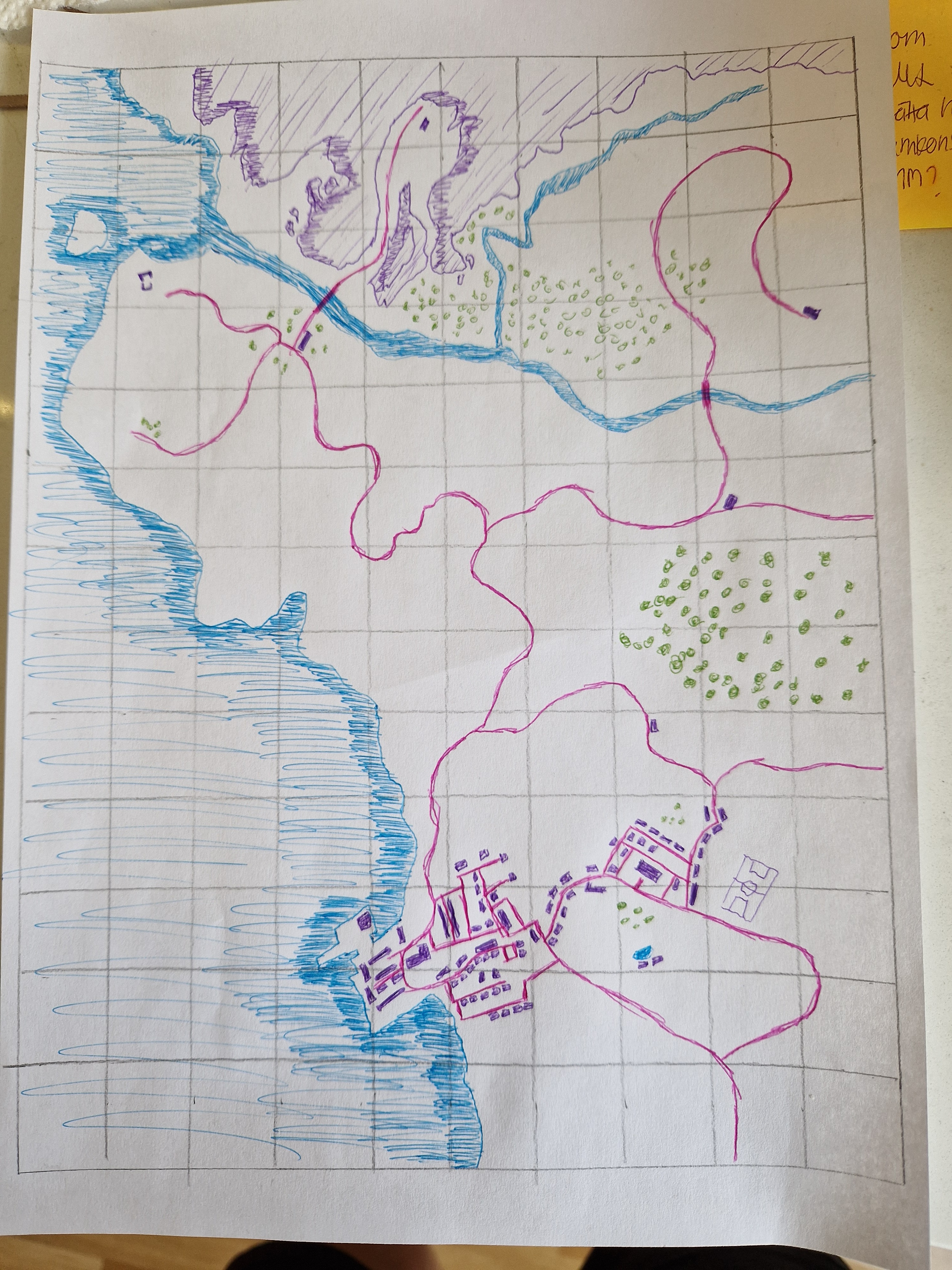
There are some details remaining, and we will need labels to remember what some of the more generic locations are. Maybe to help the children we can even print out screenshots of each location as it is rendered in the show? But that is for later. This we’re sharing just in case someone else in the world has had the same idea but does not want to do all of the stitching work.
Or, better yet, if someone has done the stitching work and done it better than us, and want to share their results with us.